
Local Bike Touring: A Low Carbon Alternative to a Road Trip. . . and Much More Fun
Bike touring can be a great way to take a vacation. You may be looking for an alternative to the same old car or airplane-based trip. You may want to satisfy your wanderlust in a climate friendly way. You may simply need to get out of town and outside. You may be looking for a way to stretch your limited vacation savings. Or you may want to get some exercise while you are traveling.
Whatever your motivation, multiple days of scenic and sustainable riding will give you a much deeper and intimate view than you can get from a car.
You can, of course, fly to Europe to embark on a bike tour. That can be a wonderful experience. But, being Cool Davis, we want to encourage you to think local. There are some quite wonderful bike tour experiences that start right from your Yolo County front door.
Whether you are an old hand at bike touring or just beginning to become interested, why not start close to home. This article will give you a few basics of equipment, safety, and modest tour routes in our immediate environs. After all, people come from all over the world to visit the Bay Area and Napa Valley to name a couple. Why not see them anew from the seat of a bike.
Basics
The bike tours I have taken have all been on a road bike. You can, of course, tour backroads on a mountain or gravel bike. The friend I normally go with is not partial to sleeping on the ground so, when I am with him, we have always stayed in a motel. But you can camp. This article will only discuss basic bike touring equipment and let you figure out the camping equipment you need if that is your preference
Even when staying at motels, space is at a premium and you can only take what is necessary. Like backpacking, weight is a factor. (It seems to become more of a factor each year.) You don’t want to carry unnecessary weight, but the good news is that it is easier to carry weight on your bike than on your back. You feel the extra weight going uphill in particular but when traveling on flat ground, a loaded bike is surprisingly easy to peddle.
You don’t need to be in great shape to bike tour. You can choose relatively easy routes and ride only as far as you want each day. Each day your stamina and tolerance of a bike seat will improve. By the end of your trip, you will be in better shape than you were in the beginning and, I venture, looking forward to the next one.
Start Local
Regardless of where you decide to go, if you have not experienced bike touring, you should warm up with a day trip or two. Collect your equipment, load your bike, and head out to a local destination for a shakedown cruise. Davis is wonderfully situated for short bike excursions. There is always the classic trip to Winters via Putah Creek Road.
Dixon is also a worthy destination to the south. Start on Old Davis Road to Tremont, then Runge and Vaughan roads into Dixon. There is a designated bike lane the entire way. Or you can go south on Runge to Hackman and then work your way west on Robben Rd. and West A street into Downtown Dixon.
Road 99 north will take you to Woodland, also with a designated bike lane. Start at Covell and John Jones Road, at Sutter Hospital, cycle north on John Jones, then travel west on County Rd. 29, then take a right on Rd. 99, which becomes West Street in Woodland. You can take a right on Main to visit restaurants and shops.
Sacramento is just a short ride over the Yolo bypass causeway, along West Capitol Ave. in West Sacramento, with its newly designated bike lane, and over the Tower Bridge into Old Sacramento.
Finally, there are many country roads to the south and northwest of Davis with almost unlimited routes and loops that are waiting to be explored.

Routes and Destinations in the Bay Area
Before turning to the practical aspects of bike touring, a look at some longer routes may be in order and hopefully a little inspirational.
The Bay Area is a destination for tens of thousands of people from all over the world, and it is right next door. The big draw for a bike tour in the Bay Area is the Bay Trail, a planned biking and walking trail that will circle the Bay with over 500 miles of trails. It is not completed yet but large portions are. Currently, there are 350 miles of bike trails and designated bike lanes along the shoreline, through parks and areas for wildlife viewing, over major bridges, and routed through cities. Check out the web site https://mtc.ca.gov/operations/regional-trails-parks/san-francisco-bay-trail/about-bay-trail where you will find maps, a route-finding device, and a description and history of the areas the trail travels through.
The trail is not contiguous. There are many gaps. The goal is to link up existing trails as much as possible. But moving from one completed section to another is generally quite easy and straightforward. The exception is the North Bay sections which are much more sparse and the connecting roads less safe.
East Bay and Peninsula Trips
I have taken two trips over to and then down the Bay Trail. Each trip was six days and about 250 miles long. That is very leisurely but it allows time for sightseeing and just sitting by the water. The first leg of each was the 45-mile ride to Cordelia. Much of the route winds along country roads with a surprising amount of bike lanes, much nicer than the I-80 corridor.
For the East Bay trip, the second leg was over the Carquinez Bridge to Pinole. From there we proceeded down the east side of the Bay. We continued around the bottom and up the west side to the Dumbarton Bridge, then across to Fremont where we caught the train home.
This bike tour will take you down new roads and give you another perspective on familiar ones. Riding your bike over the Carquinez Bridge is much more exciting and beautiful than driving over it. Richmond has a beautiful harbor and the Rosie the Riveter Museum there is worth a visit. A bike route may go through quiet residential areas to avoid busy roads and even industrial areas that can be fascinating and are actually quite safe. While there are trucks, they are generally well spaced, the roads are wide and the drivers professional.

The Peninsula trip also started with the ride to Cordelia but then went down the 680 corridor, across the Benicia-Martinez Bridge, over country roads to Pinole then over the Richmond-San Rafael Bridge and south. After a few days we again made our way over the Dumbarton Bridge and rode the train home. Seeing the huge container cranes in the Port of Oakland from the seat of a bike, looking like they just stepped out of a Star Wars movie, is a whole different perspective than you can get from a car. Near the Port are parks, a three-story observation tower, and killer views of San Francisco across the Bay. All of that is missed if you drive by on the freeway. Farther south are parks and marshes that are only lightly visited by people but populated by myriad birds.

Marin, San Francisco, and South San Francisco
The bike trails on the west side of the Bay are not as well developed but you do have the beauty of Marin County, the whole of San Francisco, and interesting areas on the Peninsula to explore. China Beach State Park in Marin County is worth visiting for the views and a look at often forgotten Bay Area history. Extensive bike infrastructure in San Francisco makes it a great city to ride in and visit by bike. The city of South San Francisco, which is easily missed on Hwy. 101, has a Victorian era downtown with restaurants and shops that make for a fun stopover. The Peninsula has its own share of water-front parks and pathways waiting to be explored.

Redding, Lodi, and Napa
Another trip you might want to consider is wheeling up to Redding. A bike route, which you will need to plan using one of the tools discussed below, winds along the river much of the time. It is much more interesting and beautiful than the I-5 corridor. And you can catch the train home. Lodi, for some wine tasting is another possible destination. Again, the bike route will put you on country roads most of the time.
Both of these trips are best taken in the cooler days of fall or spring. You may get a new perspective on the Central Valley. It can be quite beautiful and serene and, as an added bonus, it’s flat. If you want a few more hills and world class ambiance, the Napa Valley is a one- or two-day ride away, depending on the route you choose and how robust you feel.


Bike Camping Spots
If bike camping is on your agenda, Beale’s Point at Lake Folsom or Lake Solano Campground west of Winters are possible destinations. Both have tent only areas. Lake Solano has a bike or hike-in section that costs only $5 per night. The bike trip to Beale’s Point is about fifty miles, thirty-two miles of which is on the Jedidiah Smith Memorial Bike Trail along the American River. If you don’t want to camp, you can stay in Folsom, have a nice meal and bike back the next day. The ride to Lake Solano is only about 24 miles. It includes the town of Winters where you can get lunch before you wind your way through the hills for the last few miles.
Safety
Many people are reluctant to consider bike touring because they think it is unsafe. After all, cars are big and we bike riders are small. When riding a bike, try to maintain a healthy level of car paranoia. Statistically, according to the National Traffic Safety Board, your chances of a fatal bike accident are one- and one-half times that of a fatal car accident per trip. The chance is still extremely small and it does not tell the whole story. It lumps urban riding, which is generally more common and most dangerous, with riding on quiet country roads or bike paths. The trips this article describes include a substantial amount of travel on the latter. Most important, there are a number of things you can do to make your bike tour as safe as possible, so let’s turn to that.
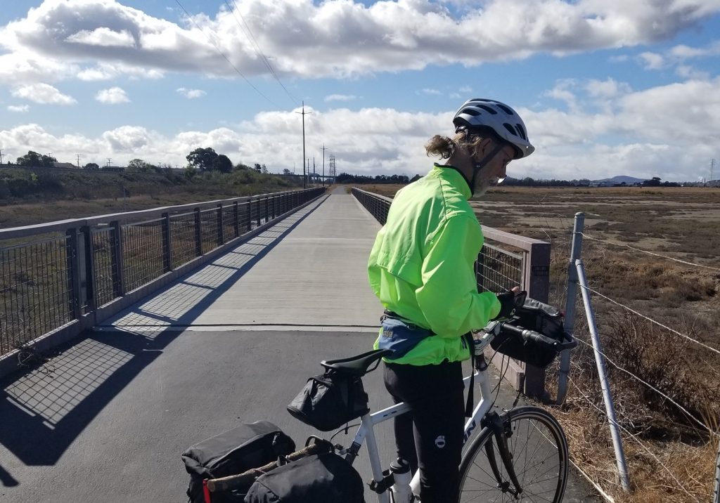
Being visible to drivers is one key to safety. A high visibility jersey or jacket and a flashing rear light are the minimum to my mind. Add a flashing headlight if you choose. Try to make eye contact with any drivers you encounter at an intersection or at least check to see if they are looking at their cell phone or you. Most unpleasant car-bike interactions happen at dusk and at night. So, while on a bike tour, come the cocktail hour, you should be settled down to the beverage of your choice and a well-deserved rest.
Route planning will be covered below but realize there are important safety considerations. A separate bike path is much safer than sharing the road with cars. When on the road, opt for designated bike lanes when possible or roads with wide shoulders. My personal preference is to ride a few miles farther if the route feels safer. Sight lines are also important. Even without a shoulder, country roads around Davis feel safe because they are straight and you are visible from a mile or more away. A road with less traffic is generally going to be safer than a heavily traveled thoroughfare, everything else being more or less equal. When possible, choose a route that is frequented by bike riders because drivers are more likely to be on the lookout for bikes. Given these factors, use your best judgement as to the safest of various route options.
Most important, stay alert and be aware of your surroundings at all times, both in front of you and behind. A rear-view mirror of one sort or other is an absolute must. There is even a bike mounted radar that will alert you to cars approaching from the rear if you want to go high tech.


Equipment
Bike touring need not be expensive. Any solid road bike, in good mechanical condition, can be the basis for a touring adventure. A steel or aluminum frame is, in fact, preferable over an expensive carbon fiber frame. It is often impossible to put a rack on the latter.
A rack with paniers (bags) is the most common arrangement for carrying clothing and gear. A rear rack with large panniers is often enough storage space; for longer trips or camping, a front rack and set of panniers may be necessary. Handlebar and seat bags are also useful for small things you want to access frequently such as snacks and a cell phone.
A good pump or CO2 cartridge inflator is a must. A basic set of bike tools and equipment adequate to change a flat and do some basic repairs on the road is also critical. A couple of water bottles, a headlight, tail light, good quality helmet, and at least two changes of clothing adequate for some inclement weather is advisable. An electronic device for route planning and keeping track of where you are is pretty much essential these days. Route planning will be covered in the next section. There are many good articles available online that can give you a complete list of items to take touring. See the resources list at the end of this article.
Route Planning
Route planning is a critical first step to any bike tour. The longer the trip, the more important it is to plan well. Google Maps is actually a good place to start. There are options, which will be discussed below, but Google is readily available and easy to use. Be sure to put it in bike route mode. There, Google will generally give you two, sometimes three routes to your planned destination. Google will prioritize separate bike paths, roads with bike lanes and less busy streets for you. You can easily insert points of interest that you want to visit off the pre-planned route. You can switch to street view to get a general sense of the width of the shoulder, condition of the roadway and such at a number of points. If you are not familiar with the suggested routes, it is important to spend a little time with street view to get a sense of what you might encounter on the trip.
A good example of the benefit of investigating alternatives are the routes from Davis to the Napa Valley suggested by Google. One is through Winters and over to the Napa Valley on Hwys. 128 and 121. That is a route that, frankly, I would not choose to take even though it is scenic. It is often narrow with no shoulder, has many sharp turns where vision is obstructed and lots of pickup trucks pulling boats.
The alternative is to ride to Cordelia and then up Hwy. 12. That route is longer and Hwy. 12 has more traffic but better sight lines and a designated bike lane all the way into Napa. Each rider will need to balance the various factors themselves. The important thing is to have the information you need to do so.
You can download the map and turn-by-turn directions Google generates onto your phone. It will keep track of where you are and provide visual and auditory instructions. If you are going to rely on your phone for navigation, a backup battery is a good investment.
There are dedicated bike tour planning devices that may also want to consider. These devices can plan a route for you, keep track of where you are, check your speed, distance traveled, elevation, inform you of upcoming hills, you name it. They will generally use less power and have a screen that may be easier to see in the sun than your phone. There are dozens of these on the market. Manufacturers with well rated products include, among others, Garmin, Hammerhead, and Wahoo
Prices for a basic device that will plan a route and keep track of where you are with a display that is easy to read while you are riding generally start around $250. Quality devices with more bells and whistles can be over $800.
The other option for route planning is a bicycle dedicated app that will help you plan a route on your phone. Three that are popular are Strava, Komoot, and Bikemap. There are many more. A simple online search for “bicycle tour planning” can fill a winter night’s reading. These may have some advantages over Google. They will not only allow you to plan a route but will generally include preloaded routes with comments and advice from riders who have taken them. These apps generally have a fairly reasonable monthly subscription price. Some will let you download a route for a fixed price.
Final Thoughts
Bike touring can be a way to see even familiar areas from a new perspective. It is a slow vacation that allows you to enjoy the natural beauty, people, parks, and towns along the way. It is a low carbon and inexpensive alternative to a typical road or plane trip. All the better if you can avoid a car or plane entirely. Touring does not require a lot of expensive equipment and doesn’t demand that you be in great bike-riding shape. If you want to ride just 15 or 20 miles in a day, you can. But a 40- or 50-mile ride in a day is easily within the grasp of most riders and many can go farther if they want to. If you might want an assist, ebikes are becoming more common, even when touring. You don’t need to go anywhere fast and can enjoy your time on the road, one day at a time.
A Few Resources
https://www.biketours.com/start-small/
https://www.rei.com/learn/expert-advice/introduction-to-bike-touring.html

Follow Us


FACEBOOK FEED
Stand with Cool Davis! The Cool Davis board of directors is working hard to move our organization towards a future that belongs to everyone. Anyone — friends, family, neighbors, organizations, and businesses – can donate starting TODAY, April 18 through midnight May 2, 2024, to support the work of Cool Davis in the community. Small amounts can make a big difference! #bdog2024
Kerry Daane Loux Kristin Heinemeier LisaABaker, Jason Bone, Ken Kirsch MAK Design+Build Inc. Christine Granger Matt Price Rekha Vaitla Johannes Troost www.bigdayofgiving.org/cooldavis
